Oceanology International (Oi) 2016 was once again a very successful event. Oi is a great opportunity to connect with the global marine science and ocean technology community on a large scale.
Our CARIS team showcased the many capabilities of CARIS products to both new and existing partners ali…
Five Locations now open and Panama City, Panama just announced as a new stop for the World Tour.
Find out about the latest CARIS technology through hands-on exercises, detailed demonstrations, and information sessions.
Visit our web page at http://www.caris.com/worldtour/ to see all the tour lo…
Darwin, Australia, is world-renowned for its rich and diverse landscapes. However, as a scientific exploration party has just found out, there is an equally diverse and previously undiscovered region of Darwin under the sea. A marine survey tasked with mapping the seabed of Darwin Harbour in …
Find out about the latest CARIS technology through hands-on exercises, detailed demonstrations, and information sessions.
Wellington, New Zealand is now open for registration. Visit our web page at www.caris.com/worldtour to see all the tour locations and register for one near you.
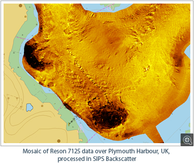
CARIS is pumped up for a great show at Oi this year. We will be releasing HIPS and SIPS™ 9.1 to coincide with the event. The new backscatter processing engine is one of the main features of the latest version. Be sure to stop by for a demo and discover how to dramatically improve your i…
Originally constructed in the North East of England in 1888, the SS Polwell was in use by German forces at the start of World War I. However, early in the war the vessel was captured off Gibraltar by the British Admiralty and requisitioned into service as a defensively armed merchant ship.
On …
The use of near real-time data processing software, such as CARIS Onboard™, has significant benefits in supporting hydrographic surveys for Rapid Environmental Assessment (REA). REA is a North Atlantic Treaty Organization (NATO) introduced concept, created to help quantify the environme…
Hydrographic data stakeholders are invited to get together at the Open Geospatial Consortium (OGC) technical committee meeting in Washington, DC on Thursday March 10th to discuss the merits of forming a "Maritime Domain Working Group". The idea for this group is to discuss interoperability be…
During the Meso American-Caribbean Sea Hydrographic Commission (MACHC) meeting, which was held in December 2015 in Antigua, staff from CARIS demonstrated the capability of conducting an unmanned hydrographic survey, processing the data and generating a nautical chart within 24 hours.
A Teledyn…
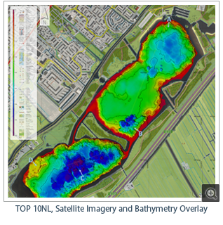
For the 2015 installment of the Lake Survey project, CARIS was pleased to join forces with Fugro Survey BV to organize a practical survey week for third year students from the Maritime Institute Willem Barentsz (MIWB). This year the location chosen to run the project was the Vlietland in Leid…
Students and instructors from the University of Washington's School of Oceanography, a member of the CARIS Academic program, are on a research vessel that is mapping the Puget Sound. Students are getting hands-on experience using the latest multibeam sonar technology to gather the data. CARIS…
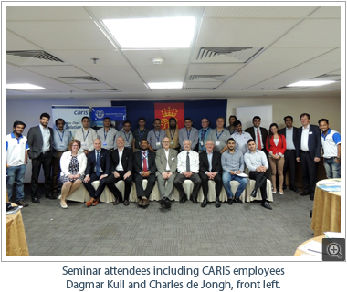
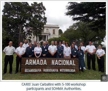
As part of the International Hydrographic Organization (IHO) Capacity Building Program, CARIS has recently delivered hands-on workshops for participants from the South West Atlantic Hydrographic Commission (SWAtHC) and the South-East Pacific Regional Hydrographic Commission (SEPRHC).
S-100 Wor…
Find out about the latest CARIS technology with hands-on software exercises – detailed demonstrations — information session.
Click on the World Tour icon for more information and register for our detailed updates.
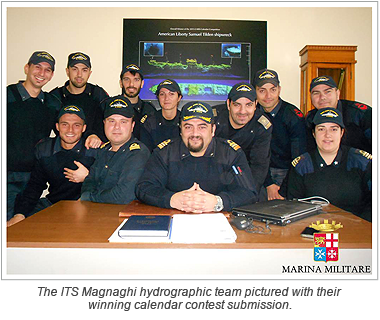
The votes are in and the winners of the CARIS calendar contest have been selected. Congratulations to all of the winners. The winning images will be included in the upcoming 2016 CARIS calendar and featured on the CARIS website.
Congratulations to Fabio Sacchetti from Marine Institute Galway w…
Through a competitive tender process The Swedish Maritime Administration (SMA) has chosen CARIS Hydrographic Production Database (HPD) as the new system to meet the Hydrographic Office's current and future requirements.
With HPD the Hydrographic Office will have the latest and most efficient s…
CARIS was proud to be a sponsor of the Lest We Forget ~ N'oublions jamais 2015 Remembrance Day tribute dinner held in Moncton, New Brunswick. The focus of this event was to raise awareness of the contributions and sacrifices made by local men and women in uniform. The donation from CARIS help…
CARIS is pleased to announce its release of the highly anticipated, near real-time data processing and mapping application, CARIS Onboard™. The development of this new technology will revolutionize the way in which bathymetry and imagery data is processed.
CARIS Onboard automatically con…
CARIS recently completed a series of training courses with the Royal Australian Navy (RAN) in preparation to standardize the data processing and electronic charting workflows for their Survey Motor Launches (SMLs) on CARIS software. Introductory training courses were led by Tami Beduhn, Ferna…
We’ve had some fantastic entries for the CARIS 2016 calendar and we are asking for your help to select the winning images! To vote please go to the CARIS website and Facebook voting pages.
The winning images will be included in the upcoming 2016 CARIS calendar and featured on the CARIS w…
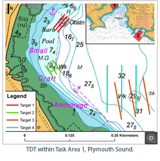
During the Shallow Survey 2015 conference held in Plymouth, UK, Teledyne and CARIS showcased the latest capabilities in autonomous survey operations with a live demonstration. Teledyne equipped a Z-Boat Unmanned Surface Vehicle (USV) with a MB1 multibeam sonar, and installed the latest versio…
After having been director of CARIS Geographic Information Systems BV, also known under its trade name CARIS EMEA, since its incorporation in 1994, Hans van Opstal decided to officially retire from the board of directors of the company from the 1st of July 2015.
Hans van Opstal laid the founda…
CARIS has been awarded a contract by the Norwegian Hydrographic Service (NHS) to deliver a data management and chart production system for the Military Geographic Institute (MGI) of Albania as part of the cooperation project Albanian-Norwegian Hydrographic Information Project (ALNO HIP). CARI…
CARIS is pleased to announce that Travis Hamilton has joined the team as the Product Manager of the newest application in the CARIS software suite, CARIS Onboard.
Travis has a bachelor's degree in Geomatics from the University of New Brunswick and is currently completing his master's degree. T…
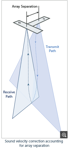
CARIS has introduced a new Sound Velocity Correction (SVC) algorithm in HIPS and SIPS that significantly improves results for many deep-water sonars. The new algorithm accounts for the separation between transmit and receive arrays when performing the ray-trace. This key change in a fundament…
The National Geospatial-Intelligence Agency (NGA) delivers world-class geospatial intelligence that provides a decisive advantage to policymakers, military, intelligence professionals and first responders. NGA has invested in a wide range of geospatial solutions from the CARIS Ping-to-Chart p…
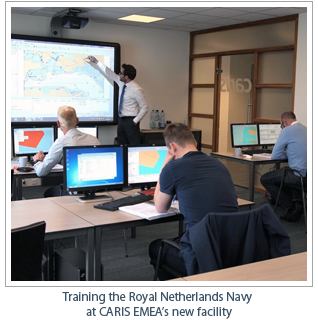
CARIS’ longest-standing European client, The Royal Netherlands Navy, was the first to experience the training facilities at CARIS EMEA’s new location, which includes the use of smart board technology. The Royal Netherlands Navy has been using CARIS software since 1986. The three-d…
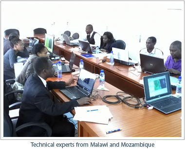
CARIS recently provided training on the new BASE Editor Limits and Boundaries software for the delimitation of the Malawi-Mozambique boundary in Lake Malawi / Lake Nyasa. The lake is Africa’s third largest and the ninth largest in the world. The training was held in the framework of the…
CARIS is looking forward to the Shallow Survey 2015 conference to be held in Plymouth, UK 14th – 18th September 2015.
In addition to the papers that we will present, we will have a stand with our lead technical experts on hand to answer questions and to demonstrate the latest technology …
CARIS™ has introduced a new sound velocity correction algorithm to HIPS and SIPS™ that significantly improves results for many mid and deep-water sonars and benefits some shallow water multi-sector systems as well.
The new algorithm was based on research from the Ocean Mapping Grou…
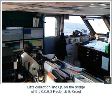
CARIS recently joined the Canadian Hydrographic Service (CHS) for their first survey of the 2015 field season aboard the C.C.G.S Frederick G. Creed. Burns Foster, Product Manager for HIPS and SIPS, met the vessel and the CHS survey team in the New Brunswick Port of Belledune to learn about th…
The 10 year anniversary of CARIS'; widely acclaimed Ping-to-Chart™ World Tour will be marked in 2016. We think that's a great excuse to embark on a new global workshop series and update your wardrobe with a new tour t-shirt at the same time. CARIS experts will be coming to a city near y…
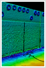
In case you missed the recent Engineering Analysis Module Webinar related to the enhancements to vertical and inclined feature modelling, it's now available on our YouTube channel.
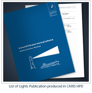
CARIS is pleased to announce that, for the first time, the latest editions of the German List of Lights have been successfully published by the The Federal Maritime and Hydrographic Agency of Germany (BSH) using the CARIS HPD Publications Module.
CARIS HPD Publications Module accesses relevant…
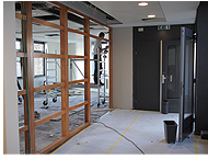
After nearly two decades at its current office in Heeswijk, The Netherlands, CARIS' European office is moving to a new location. The new office, located in the beautiful city of 's-Hertogenbosch, will double the available space and provide new facilities; including three fully equipped rooms …
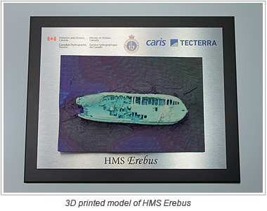
Data collected by the Department of Fisheries and Oceans’ Canadian Hydrographic Service used to develop models of HMS Erebus
Officials from Fisheries and Oceans Canada, today joined with Canadian geospatial software company CARIS and geomatics technology innovation support centre TECTERR…
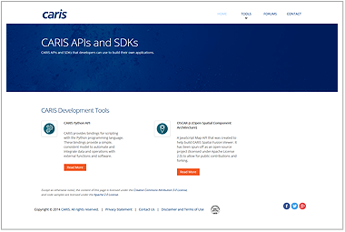
CARIS has launched a new website for developers to aid in the creation of custom applications. The new developer.caris.com website provides users with access to tools and documentation of CARIS Application Programming Interfaces (APIs) as well as a discussion forum for the collaboration of in…
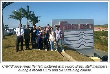
Fugro Brasil recently undertook training on the latest hydrographic data processing techniques with CARIS. Staff members, who came from diverse backgrounds in hydrography, geophysics and GIS, took part in a week-long training course in Macaé, Brasil using the latest release of CARIS HI…
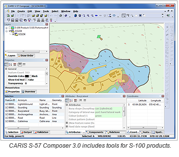
CARIS™ is pleased to announce the release of CARIS S-57 Composer™ 3.0, a desktop application for the production of electronic navigational products, including Electronic Navigational Charts (ENC), Additional Military Layers (AML), Inland Electronic Navigational Charts (IENC) and D…
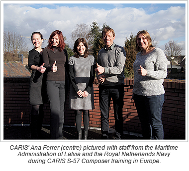
The Maritime Administration of Latvia is the latest hydrographic office to use CARIS S-57 Composer for the production of electronic navigational charts (ENCs). The Maritime Administration of Latvia, which acquired CARIS Bathy DataBASE less than a year ago for managing their survey data, has t…
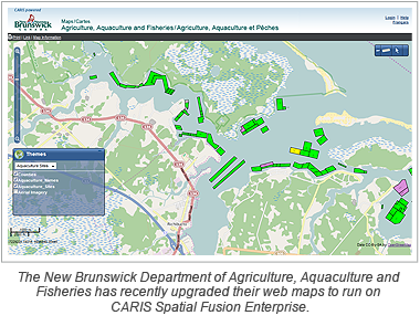
The Department of Agriculture, Aquaculture and Fisheries in New Brunswick, Canada has recently upgraded their web maps to run on CARIS Spatial Fusion Enterprise 5.8. This deployment of Spatial Fusion Enterprise includes a lightweight, easily navigable map client with a bilingual English-Frenc…
For many Small Island Developing States (SIDS), such as Antigua and Barbuda and Saint Vincent and the Grenadines, access to natural resources continues to play a critical role in shaping their sustainable economic and social development. Twenty-five of the world’s 39 SIDS are members of…
The latest release of CARIS Hydrographic Production Database (HPD) 3.1 offers an abundance of new functionality, including new comparison tools and customizable user access.
The leading database production system allows users to manage their marine spatial information and create cartographic p…