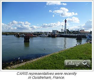
 CARIS recently visited the Ports of Normandy Authority (PNA) in Ouistreham, France for a training course on CARIS BASE Editor and Engineering Analysis Module. The Ports of Normandy Authority is responsible for the maintenance, dredging preparation and dredging monitoring of the ports of Cherb…
Newsroom
Latest news and announcements
-
CARIS BASE Editor and Engineering Analysis Module training for Ports of Normandy Authority
2013/03/11
Read More
-
IHO Marine Spatial Data Infrastructure meetings in Denmark
2013/02/25
Read More
The fourth meeting of the IHO Marine Spatial Data Infrastructure Working Group (MSDIWG) took place from January 31 to February 1, 2013 in Copenhagen, Denmark. It was preceded on January 30 by an MSDI Open Forum. Both events were held at the Danish Geodata Agency (GST) and were chaired by Mr. …
-
Marine Scotland Science updates HIPS and SIPS training to aid current projects
2013/02/25
Read More
Marine Scotland Science (MSS) recently undertook CARIS HIPS and SIPS training conducted by CARIS BV’s Michal Borkowski at the Marine Laboratory in Aberdeen, UK. The purpose of the training was to focus on streamlining workflows and processes with their multibeam data. MSS received train…
-
Crowdsourcing data to provide efficiencies in hydrographic surveying
2013/02/25
Read More
Many of the 25,000 miles of inland, intracoastal, and coastal waterways that link thousands of ports and harbours in the U.S. have never been completely surveyed. In those areas that have been surveyed, approximately half of the depth sounding data shown on U.S. nautical charts are from befor…
-
CARIS workshops at Ocean Business 2013
2013/02/25
Read More
 CARIS will be hosting two free workshops at Ocean Business 2013 in Southampton, UK during April 9 - 11, 2013.
Bathymetric Processing and Data Management
Tuesday, April 9, 2:00 p.m. - 3:00 p.m.
Access Grid Room 124/14This workshop will focus on data processing techniques, including the suppleme…
-
Inland Electronic Navigation Chart production at the Flemish Hydrography
2013/02/11
Read More
Safety of navigation on inland waterways is as important as in maritime waters. Inland waterways have specific features and regulations that are different from maritime waterways, making the use of existing Electronic Navigation Charts (ENC) insufficient. As a result, international standards …
-
CARIS Bathy DataBASE and HPD workflow training for CHS
2013/02/11
Read More
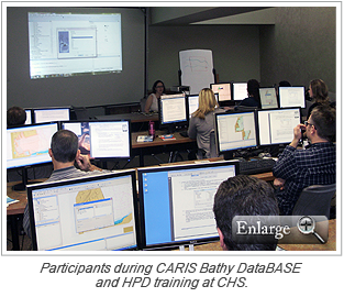 CARIS recently conducted a training course with the Canadian Hydrographic Services (CHS) in Burlington, Ontario, Canada which focused on the chart compilation workflow between CARIS Bathy DataBASE and CARIS Hydrographic Production Database (HPD).
The training course covered components of chart…
-
Upcoming CARIS workshop at US Hydro 2013
2013/02/11
Read More
CARIS will be hosting a free workshop at the US Hydro 2013 conference in New Orleans, Louisiana taking place March 25 - 28, 2013. The workshop will cover the latest hydrographic data processing and management software.
During the workshop CARIS experts will guide attendees through the post-pro…
-
Indonesia becomes latest nation to implement HPD
2013/02/11
Read More
-
HPD training for Panama Canal Authority
2013/01/28
Read More
CARIS recently spent four weeks at the Panama Canal Authority (ACP) conducting training and consultancy on CARIS Hydrographic Production Database (HPD). ACP selected HPD for marine spatial data management and security, and to obtain further efficiencies in chart production.
During the training…
-
Kayak bathymetry mapping project
2013/01/28
Read More
As a geomatics professional and avid kayaker involved in training, consulting and supporting CARIS bathymetric processing software, CARIS Customer Service representative Matthew Gudger decided to assemble a simple and easy to use kayak mounted bathymetric mapping system which could be used to…
-
HIPS and SIPS training for Hong Kong Marine Department
2013/01/28
Read More
CARIS was recently in Hong Kong conducting a CARIS HIPS and SIPS training course with the Hong Kong Marine Department. The Marine Department is responsible for all navigational matters in Hong Kong and the safety standards of all classes and types of vessels.
The primary focus of the training …
-
IMO/IHO/SHOM hydrography and cartography training course in Ivory Coast
2013/01/14
Read More
The International Maritime Organization (IMO), in collaboration with the International Hydrographic Organization (IHO) and the French Hydrographic Office (SHOM), recently held a two-week training course in hydrography and nautical charting for the benefit of French-speaking African countries.…
-
CARIS LOTS training for Ghana
2013/01/14
Read More
-
Coastal Consulting & Exploration receives poster of winning calendar entry
2013/01/14
Read More
-
CARIS and EIVA partner to provide efficient solution for offshore surveys
2013/01/08
Read More
CARIS and EIVA have signed a Memorandum of Understanding (MoU) to collaborate on providing offshore survey organizations with a tightly integrated and streamlined solution. Both companies develop state-of-the-art software for the marine offshore market. CARIS is a world leader in software for…
-
CARIS event at UK Hydrographic Office
2012/12/20
Read More
The United Kingdom Hydrographic Office (UKHO) ran an event entitled CARIS on the Desktop on November 13 and 14, 2012. The event was intended to show staff how their desktop would look in the future: how surveys will be handled, charts constructed and data maintained.
In total 350 staff attende… -
Pelydryn workshop at ELMF
2012/12/20
Read More
-
Upcoming HIPS and SIPS training in the Netherlands
2012/12/20
Read More
CARIS is pleased to announce an upcoming HIPS and SIPS training course for marine and hydrographic professionals at the CARIS BV office in Heeswijk, the Netherlands. The hands-on training course will be held January 21-25, 2013 and will focus on data processing, visualization, quality control…
-
Merry Christmas from CARIS
2012/12/20
Read More -
Successful Marine Spatial Data Infrastructure workshop held in Brazil
2012/12/10
Read More
Attendees from the South West Atlantic Hydrographic Commission (Brazil, Argentina and Uruguay) and representatives from Guatemala, Chile and Colombia successfully completed an International Hydrographic Organization (IHO) capacity building workshop on Marine Spatial Data Infrastructure (MSDI)…
-
Successful Bathy DataBASE training in Australia
2012/12/10
Read More
CARIS Asia Pacific recently held an open training course in Adelaide, Australia for the new release of Bathy DataBASE 4.0. The course attracted a number of new and current users ranging from port authorities, charting agencies and private survey companies. Participants received hands-on exper…
-
Five-day mid-water multibeam surveyor training course
2012/12/10
Read More
-
CARIS wins project with Norwegian Hydrographic Service
2012/12/10
Read More
After taking part in a competitive tender process, CARIS is pleased to announce that it has been awarded the PLECO Project with the Norwegian Hydrographic Service (NHS).
The NHS, a division of the Norwegian Mapping Authority, is responsible for surveying the Norwegian coast, including polar wa… -
Enhanced usability and performance with CARIS Spatial Fusion Enterprise 5.7
2012/12/10
Read More
-
Limits and Boundaries training for Swedish Maritime Administration
2012/11/23
Read More
 The Swedish Maritime Administration (Sjöfartsverket) recently received CARIS LOTS training delivered by CARIS’ Vittorio Zanobbi. Vittorio is one of CARIS’ limits and boundary delimitation experts and he conducted the training course as part of the CARIS LOTS Limits and Bounda…
 -
Successful voyage on the SS Rotterdam
2012/11/23
Read More
-
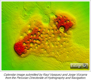
Download your CARIS desktop calendar
2012/11/23
Read More
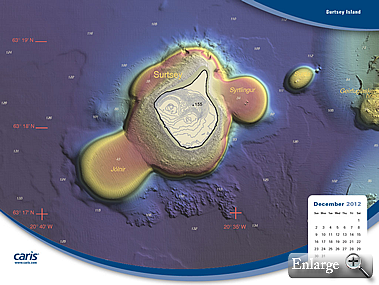 The winning images from the 2013 CARIS Calendar Contest are now available for download as a desktop calendar. Each month enjoy a new image submitted by CARIS users. The desktop calendar images are available in a variety of resolution sizes, including one for your mobile phone.
Download the Dec…
-
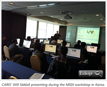
Successful Marine Spatial Data Infrastructure workshop held in Korea
2012/11/23
Read More
-
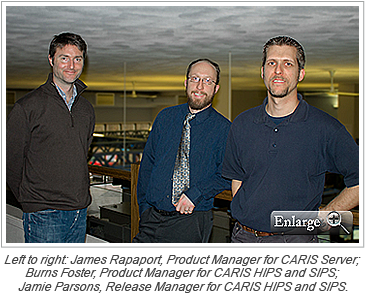
New appointments at CARIS
2012/11/09
Read More
-
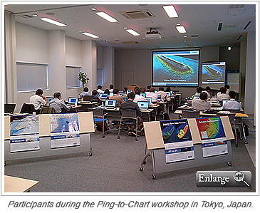
Latest Ping-to-Chart workshop: Tokyo, Japan
2012/11/09
Read More
-
Meet CARIS at Hydro12 in Rotterdam
2012/11/09
Read More
During November 13 to 15 the Hydrographic Society Benelux will be hosting Hydro12 in Rotterdam, Netherlands. On board the SS Rotterdam, this venue is an excellent opportunity to meet CARIS. Come and visit us at booth L10-L11 on the Atlantic Promenade deck, where CARIS domain experts will be h…
-
2013 CARIS calendar entries now on YouTube
2012/11/09
Read More
The short list of calendar entries for the 2013 CARIS calendar contest is now available on YouTube for your viewing pleasure. Visit the CARIS YouTube channel to see some of the impressive images submitted by CARIS users.
Thank you to everyone that participated in the 2013 calendar contest!
… -
Upcoming HIPS and SIPS training in the Eastern United States
2012/10/26
Read More
CARIS and the University of Delaware are pleased to offer CARIS HIPS and SIPS training to marine and hydrographic professionals in the Eastern United State region. The training course will take place in Newark, Delaware from November 12 - 16, 2012. This comprehensive hands-on session will foc…
-
Download the latest version of CARIS' freeware viewer for 2-D and 3-D data
2012/10/26
Read More
CARIS announces the release of CARIS Easy View 4.0, a freeware data viewer for 2-D and 3-D data. CARIS Easy View 4.0 replaces the popular CARIS Easy View 2.0 which has been downloaded by thousands of professionals and students. CARIS Easy View allows users to view spatial data from a wide ran…
-
CARIS releases HPD 2.9.2
2012/10/26
Read More
-
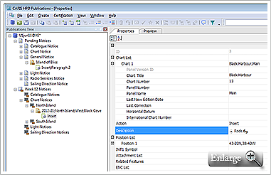
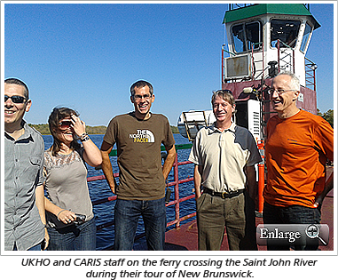
UKHO project team experiences New Brunswick
2012/10/26
Read More
-
CARIS workshop at RESON User Conference
2012/10/26
Read More
 CARIS will be hosting a free half-day workshop covering the latest hydrographic data processing and management software at the RESON User Conference in Miami, Florida on Thursday, November 8, 2012.
The workshop will take attendees through the full post-processing workflow using CARIS HIPS and …
-
CARIS Bathy DataBASE 4.0 provides speed and scalability
2012/10/19
Read More
CARIS is pleased to announce the release of Bathy DataBASE 4.0, the leading solution for managing and analyzing bathymetry data. Powered by the CSAR engine and backed by proven RDBMS technology, Bathy DataBASE delivers a robust and scalable solution for the storage and analysis of ever-expand…
-
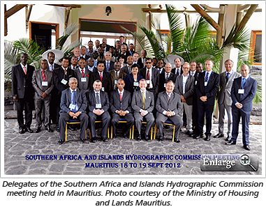
CARIS attends Southern Africa and Islands Hydrographic Commission meeting
2012/10/11
Read More
-
Upcoming Bathy DataBASE 4.0 training in Australia
2012/10/11
Read More
CARIS is pleased to offer marine and hydrographic professionals in the Asia Pacific region CARIS Bathy DataBASE 4.0 training in Adelaide, Australia from October 31 – November 2, 2012. The training course will be a comprehensive hands-on session on the leading system for managing and ana…
-
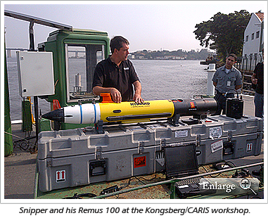
Kongsberg and CARIS team up for Brazil workshop
2012/10/11
Read More
-
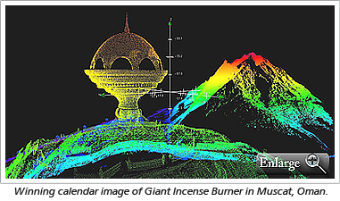
Winning calendar image
2012/10/11
Read More
-
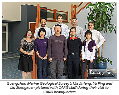
Guangzhou Marine Geological Survey visits CARIS headquarters
2012/09/28
Read More
-
Upcoming HIPS and SIPS training in the UK
2012/09/28
Read More
CARIS and the Offshore Marine Academy are pleased to offer CARIS HIPS and SIPS training in Bristol, UK on October 22-26, 2012. The training course, geared towards existing and prospective customers, will be a comprehensive session on industry leading data processing, visualization, quality co…
-
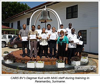
Maritime Authority Suriname selects CARIS solutions for chart production
2012/09/28
Read More
-
Port of Melbourne Corporation selects CARIS for bathymetric database system
2012/09/20
Read More
CARIS has recently completed a successful project for the provision of a bathymetric database system for the Port of Melbourne Corporation (PoMC).
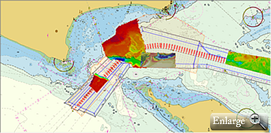 Bathymetric surveys loaded in the database at the entrance to Port Phillip Bay.
PoMC conducts regular bathymetric surveys as part of its statutory o…
-
CARIS visits Myanmar following political changes
2012/09/14
Read More
-
Search for Franklins ships expands navigation in Canadian Arctic
2012/09/14
Read More
A six-week search effort is currently underway in the Canadian Arctic to find the lost ships of Sir John Franklin’s ill-fated 1845 expedition to chart the Northwest Passage. The lost ships, HMS Erebus and HMS Terror, have been sought for more than 160 years and have yet to be discovered…
-
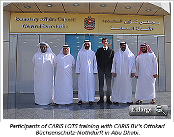
CARIS LOTS training in United Arab Emirates
2012/09/14
Read More
Join our Mailing List
Subscribe to email announcementsOur Latest Tweets
Tweets by Teledyne CARIS Follow us on TwitterConnect With Us


