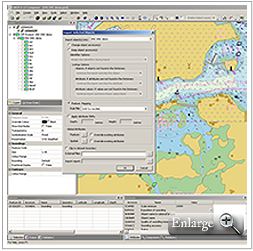
I would like to thank all readers of the Coastlines e-newsletter for their kind feedback. I will be leaving CARIS next week and am handing over the e-newsletter's reins on to Andrew Hoggarth. If you have news that you would like included in Coastlines please contact Andrew Hoggarth, Marketing…
Newsroom
Latest news and announcements
-
Goodbye to all Coastlines Readers from Alex Palmer
2011/09/23
Read More
-
CARIS Calls for Entries to 2012 Calendar Contest
2011/09/09
Read More
CARIS is encouraging users of its software to enter their geospatial datasets, maps, charts or 3D views to the 2012 CARIS Calendar Contest. The Contest represents a fantastic opportunity for the CARIS user community to showcase their favourite CARIS images.
All winning images will be featured …
-
HIPS and SIPS Training in the US
2011/09/09
Read More
A three-day HIPS and SIPS training session has been scheduled at our US office in Alexandria, VA. This training will be a comprehensive session on leading data processing, visualization, quality control and product creation techniques using the latest HIPS & SIPS release - 7.1.
HIPS and SI…
-
Free CARIS HIPS and SIPS Seminar for Delegates of Reson User Conference
2011/09/09
Read More
CARIS will be offering an afternoon hands-on-training seminar at the Reson User Conference covering the latest HIPS multibeam data processing techniques. The Reson User Conference is taking place from October 31st to November 3rd at the Hyatt Regency in Jersey City, USA.
Topics in the seminar …
-
Vancouver Announced as Host City for 14th International CARIS User Conference
2011/08/19
Read More
Vancouver, Canada will provide the inspiring backdrop to the 14th International CARIS User Conference taking place from June 25th to 28th, 2012. Canada's proclaimed "Gateway to the Pacific" famously hosted thousands of athletes and visitors from around the world as the host city for the Winte…
-
Building Hydrographic Capacity in Antigua and Barbuda
2011/08/19
Read More
The International Hydrographic Organization (IHO) Capacity Building Sub Committee (CBSC) and Meso American and Caribbean Sea Hydrographic Commission (MACHC) recently executed an Introduction to Hydrographic Surveying and Nautical Cartography training course in St. John's, Antigua and Barbuda.…
-
Josh Mode Appointed CARIS' New Academic Liaison
2011/08/19
Read More
CARIS is pleased to announce the appointment of Josh Mode as their new Academic Liaison. His responsibility will be to further develop CARIS' Academic Partnering Program, which currently provides geospatial software to more than 75 academic institutions around the world.
CARIS' Academic Partne…
-
Processing Optimized in Database Chart Production Software Release
2011/08/19
Read More
CARIS, the world’s leading marine GIS organization, has announced the release of HPD 2.9, their advanced database chart production software. HPD is part of a range of software that together makes-up the unique CARIS Ping-to-Chart solution.
Enhancements to the software have been made to a…
-
Register now for Free CARIS Webinar
2011/08/19
Read More
A free CARIS webinar is being offered on how to effectively analyze, store and manage your bathymetric data.
Our CARIS Australia team in Adelaide is hosting the webinar on Friday, August 19th at 10:30am - 11:30am Australia Central Standard Time. More information and registration details can be…
-
HIPS and SIPS Training in the US (1)
2011/08/19
Read More
A HIPS and SIPS training session has been scheduled at our US office in Alexandria, VA. This training will be a comprehensive session on leading data processing, visualization, quality control and product creation techniques using the latest HIPS & SIPS release - 7.1.
HIPS and SIPS Trainin…
-
CARIS Offers Port Engineering Solution in Latest Bathy DataBASE Release
2011/07/15
Read More
CARIS, the world's leading marine GIS organization, has launched a new module as part of the release of Bathy DataBASE 3.2. The Engineering Analysis Module caters to the requirements of the dredging industry, port and waterway authorities, as well as other engineering operations.
 The Engineeri…
 -
Italian Navy Successfully Migrates Bathymetry Data to CARIS Bathy DataBASE
2011/07/15
Read More
The Italian Navy has successfully migrated its bathymetry data from its legacy system to Bathy DataBASE. The adoption of Bathy DataBASE followed a period of consultancy with CARIS at the Italian Navy's offices at the Istituto Idrografico della Marina in Genoa. The consultancy identified the s…
-
The Royal Navy of Oman Signs Five-Year Deal with CARIS
2011/07/15
Read More
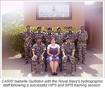 The Royal Navy of Oman has signed a five-year agreement covering CARIS training and subscription. The contract will ensure that the Royal Navy of Oman will benefit from the latest versions of CARIS software and their staff, who use CARIS software, are trained to fully utilize the software&rsq…
 -
New CARIS Training Dates Announced
2011/07/15
Read More
Three new training dates have been announced to ensure that users get the most out of their CARIS software.
Two Bathy DataBASE workshops have been scheduled. These will focus on the use of tools for importing, validating, analyzing and extracting bathymetric data, on the compilation and manage…
-
New Release of Spatial Fusion Enterprise® Offers Support for WFS 2.0
2011/07/15
Read More
Spatial Fusion Enterprise, the only Open Geospatial Consortium (OGC®) Web Server and Viewer built with distribution of marine geospatial data in mind, has a set of new features providing further improvement to the software's data sharing and analysis tools.
Spatial Fusion® Server (SFS)…
-
HIPS and SIPS Webcast Released on CARIS' YouTube Channel
2011/07/15
Read More
An edited version of the popular CARIS HIPS and SIPS webinar is now available on CARIS' YouTube Channel. If you missed the opportunity to view the webinars, or wish to view the demonstration once again, please visit:
…
http://www.youtube.com/user/CARISGIS?feature=mhee#p/a/u/0/iHwKRnlepsg -
OceanWise and CARIS Deliver Inaugural 'Marine SDI' Management Course in Bangkok on Behalf of East Asia Hydrographic Commission
2011/07/13
Read More
July 13, 2011 - The first in a series of courses on the theoretical and practical aspects of hydrographic database design and management to support the development of marine, national and regional spatial data infrastructures (SDI) was delivered successfully from June 20th to 24th, 2011 in B…
-
Seamount Named after CARIS Employee
2011/06/24
Read More
Having a seamount named after you is a rare distinction, and CARIS employee Dan Donnell has received this honour.
The Donnell Seamount is located at 50º05.1338”N and 45º21.5796”W and has a summit depth of 1893 meters.
Dan Donnell receives this honour following 40 years of …
-
CARIS Wins Exporter of the Year
2011/06/24
Read More
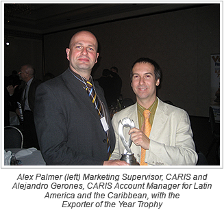 CARIS, the world's leading marine GIS organization, has scooped the flagship award at the 2011 New Brunswick Export Achievements Awards held on May 26, 2011.
The Exporter of the Year award recognizes outstanding performance in the international marketplace. The award was presented by Economic …
-
Extra Date Added for Optimizing Your Processing Productivity Webinar
2011/06/24
Read More
Due to popular demand, an additional webinar date has been added for the HIPS and SIPS webinar: Optimizing Your Processing Productivity. The webinar, at a time suitable for the Asia Pacific region, will take place on Friday, June 10, 2011 at 10:30-11:30 Australian Central Standard time.
Click …
-
CARIS Becomes First Sustaining Partner for Australia's Hydrography Commission
2011/06/17
Read More
CARIS, the world’s leading marine GIS organization, are pleased to announce that they have become the first sustaining partner of the Surveying and Spatial Science Institute’s Hydrography Commission (SSSI) in Australia.
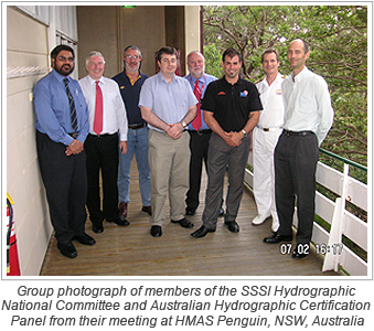 The SSSI is the governing professional body for the spatial in…
 -
Technical Solutions Provider Appointed at CARIS Asia Pacific
2011/06/17
Read More
 CARIS, the world's leading marine GIS organization, is pleased to announce the appointment of Daniel Kruimel as CARIS Asia Pacific's Technical Solutions Provider.
This new position will enable CARIS to offer additional technical expertise to CARIS' expanding client base in the Asia Pacific reg…
-
CARIS Database Solution Completes Canadian Hydrographic Information Network
2011/06/03
Read More
CARIS' Bathy DataBASE (BDB) software has provided the last link of a 25 year project enabling the Canadian Hydrographic Service (CHS) to implement their Hydrographic Information Network.
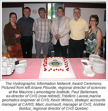 The Hydrographic Information Network project involved innovative changes, including adopting a multi-discip…
 -
CARIS Employees Celebrate World Hydrography Day
2011/06/03
Read More
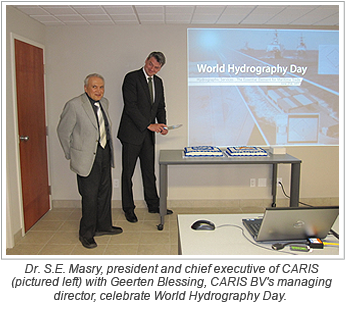 World Hydrography Day is celebrated each year on June 21st, which is the anniversary of the founding of the International Hydrographic Office in 1921. The day recognises the achievements of the hydrographic community and raises awareness of the importance of hydrography.
This year, CARIS, the …
-
Successful HIPS and SIPS Training in United Arab Emirates
2011/06/03
Read More
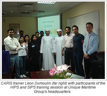 The first training course jointly organized by CARIS and the Unique Maritime Group of the United Arab Emirates took place from May 8th to May12th.
The comprehensive five-day training course attracted marine and hydrographic professionals from ten countries to the Unique Maritime Group's headqu…
-
CARIS Wins Waterway Project with Rijkswaterstaat
2011/05/20
Read More
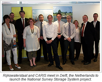 After taking part in a competitive tender process, CARIS is pleased to announce that it has been awarded the National Survey Storage System project from Rijkswaterstaat.
Rijkswaterstaat, the executive body of the Ministry of Infrastructure and Environment in the Netherlands, has several respon…
-
CARIS Workshop at INSPIRE Conference
2011/05/20
Read More
CARIS will hold a workshop on seafloor data titled "Effective Marine Data Management and Dissemination." At the INSPIRE Conference 2011
INSPIRE (Infrastructure for Spatial information in Europe) is a directive established by the 27 member countries of the European Union to ensure that their sp…
-
HIPS and SIPS Utilized in the Search for Corals in the Drake Passage
2011/05/20
Read More
Have you ever wondered what it is like to be on a marine research expedition?
Wonder no more! A blog promises to provide an interesting insight into an expedition that is using HIPS and SIPS to help research the corals that live in some of the most extreme conditions on the planet.
Shanno…
-
New License Required for HIPS and SIPS 7.1 Release
2011/04/29
Read More
The next release of HIPS and SIPS, CARIS' advanced hydrographic software solution, will require a new license string to operate.
HIPS and SIPS 7.1 is scheduled for release in early May, highlights include a new 64-bit version of the software in addition to the 32-bit one. This advancement will…
-
The Royal Netherlands Navy and CARIS Celebrate 25 years of Cooperation
2011/04/29
Read More
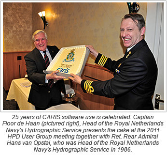 In 1986 the Royal Netherlands Navy became CARIS' (then known as Universal Systems Limited) first international customer when the Navy's Hydrographic Service purchased CARIS for their nautical paper chart production. Now, 25 years later, CARIS is the preferred solution for hydrographic offices…
 -
CARIS launches Spatial Fusion® Enterprise 5.4 with OGC® Web Coverage Services
2011/04/29
Read More
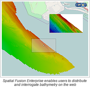 The latest release of Spatial Fusion Enterprise is building on its support of Open Geospatial Consortium (OGC) standards by implementing the Web Coverage Service (WCS) standard for bathymetric data. This is a continuation of CARIS’ commitment to provide organizations with the latest tec…
 -
Processing Efficiencies Realized with Latest HIPS and SIPS
2011/04/15
Read More
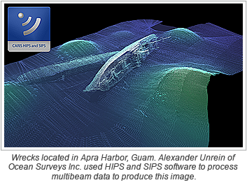 CARIS, the world's leading marine GIS organization, has today released a 64-bit version of its comprehensive hydrographic processing software HIPS and SIPS.
HIPS and SIPS 7.1 with 64-bit support will provide users who have access to a 64-bit computer the ability to handle large multibeam sonar…
-
CARIS and RiChi's Collaboration Benefits the Geospatial Community in Taiwan
2011/03/25
Read More
 CARIS and RiChi are pleased to announce their partnership to help provide the best possible geospatial solutions for the Taiwanese market.
CARIS had partnered with the RITI Technology Group in the Taiwanese market for more than 15 years before the spin off by RITI of their Geospatial Products …
-
Canadian Federal Minister Visits CARIS HQ
2011/03/18
Read More
 CARIS welcomed the Honourable Keith Ashfield, Canada's Minister of National Revenue, Minister of the Atlantic Canada Opportunities Agency (ACOA) and Minister for the Atlantic Gateway, to their headquarters last week.
Minister Ashfield's visit to CARIS had been initially arranged following a bu…
-
CARIS' LOTS Featured in IBRU Newsletter
2011/03/18
Read More
CARIS' LOTS software was featured in the International Boundaries Research Unit's (IBRU) newsletter, Borderlines.
LOTS is a mapping software package developed to address coastal states' territorial claims. The CARIS software was used by IBRU researchers to map the contested maritime space arou…
-
CARIS Releases GIS Professional 4.5
2011/03/18
Read More
This month CARIS released GIS Professional 4.5. The software is designed to provide a comprehensive spatial information management tool that addresses the GIS needs of a marine operational environment. The new version is now compatible with Windows 7.
If you’re interested in learning mor…
-
CARIS launches Bathy DataBASE 3.1 with support for Oracle® Spatial
2011/03/04
Read More
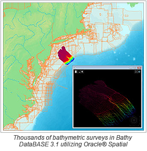 CARIS, with its latest Bathy DataBASE 3.1 software release, continues to solve the demands for robust and scaleable data management for the storage and analysis of ever-expanding volumes of sonar and LiDAR data.
Bathy DataBASE now works with Oracle® Spatial 11g utilizing the GeoRaster and …
-
Conversion from ENC to DNC Made Easier with the Launch of S-57 Composer 2.2
2011/01/28
Read More
-
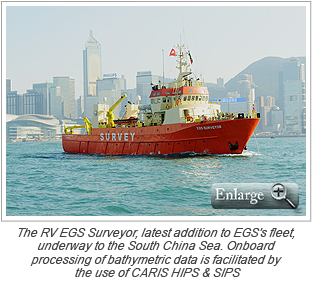
CARIS HIPS and SIPS Plays an Integral Part in EGS Group Expansion
2011/01/21
Read More
-
CARIS Offers Free Workshops on Latest Releases at Ocean Business 2011
2011/01/07
Read More
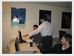 The Ocean Business exhibition at the National Oceanography Centre in Southampton, England has quickly established itself as one of the premier events for showcasing the latest in ocean technology. Therefore, it should come as no surprise that CARIS is playing an active role at the exhibition …
 -
CARIS Academic Program promoted in San Francisco
2010/12/17
Read More
CARIS is currently exhibiting at the American Geophysical Union meeting in San Francisco (ends December 17). The focus for CARIS is the promotion of the highly successful Academic Partnering Program, which currently provides over 60 universities and other academic institutions with the most c…
-
HIPS and SIPS training
2010/12/17
Read More
CARIS is organizing HIPS and SIPS training in Fredericton, Canada on January 10-14. The main focus of the training will be on data processing, visualization, quality control and product creation techniques. The latest technology in the software will be covered to enable participants to improv…
-
CARIS' expertise highlighted at Chilean exhibition
2010/12/16
Read More

CARIS' Andy Hoggarth and Alejandro Gerones with Rodolfo Sabonge, VP of the Panama Canal Authority and Keith Ashfield, Canada's ACOA Minister at EXPONAVAL 2010
CARIS was recently invited to take part in a business mission organized by the Atlantic Canada Opportunities Agency to EXPONAVAL 2010 i…
-
Connect with CARIS
2010/12/03
Read More
Connect with CARIS

Would you like to keep up-to-date with what is happening at CARIS?
Would you like to be involved in exchanging information, ideas and opportunities with the CARIS community?CARIS now has an active and regularly updated presence on a number of social media platforms where you…
-
Panama Canal Safer thanks to CARIS Solution
2010/09/22
Read More
The Panama Canal Authority has successfully completed the first round of tests in the installation of its new Electronic Navigational Chart (ENC) system utilizing CARIS software at the Simulation Center, Research and Development Maritime in Panama. This new system will make navigation in the …
-
CARIS measures improved performance with Spatial Fusion Enterprise 5.3
2010/08/31
Read More
CARIS is pleased to announce the release of Spatial Fusion Enterprise (SFE) version 5.3 featuring the new Web Map Tile Service (WMTS). SFE allows an organization to deliver its geospatial information to the Web using open standards and the latest technology.
WMTS is an Open Geospatial Consorti…
-
CARIS Announces Bathy DataBASE 3.0 with seamless land and sea integration
2010/06/16
Read More
CARIS is pleased to announce the release of Bathy DataBASE 3.0.
A robust and efficient data management system is considered essential by those progressive organizations who have a desire to manage, visualize and analyze their ever-expanding volumes of bathymetry data. This need is now becoming…
-
CARIS Conference Attracts Record Numbers
2010/04/16
Read More
CARIS hosted its 13th International User Group Conference, CARIS 2010, at the Four Seasons hotel in Miami, Florida, USA on March 22 - 25, 2010.
Stronger Together - People, Products, Infrastructure was this year's conference theme that brought together delegates from a record number of Nations.…
-
CARIS Launches Spatial Fusion Enterprise 5.2 at Oi10
2010/03/03
Read More
CARIS, a leading developer of marine GIS and hydrographic software, announced today the release of Spatial Fusion Enterprise (SFE) 5.2 as part of its well known Ping-to-Chart™ product suite.
SFE is Web-enabling technology for geospatial information that aims at leveraging the investment …
-
CARIS and University of Southern Mississippi Partner for Tenth Year
2010/01/13
Read More
CARIS, leading developer of marine GIS and hydrographic software, announced today the renewal of its Academic Partnership with the University of Southern Mississippi (USM) for the tenth consecutive year.
Through the Program, USM has access to multiple CARIS software products, quality technical…
Join our Mailing List
Subscribe to email announcementsOur Latest Tweets
Tweets by Teledyne CARIS Follow us on TwitterConnect With Us


