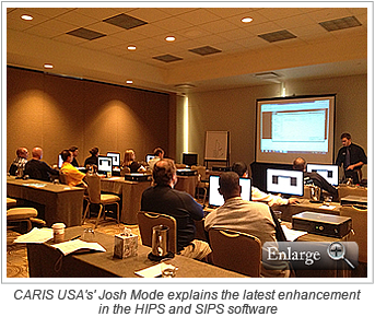
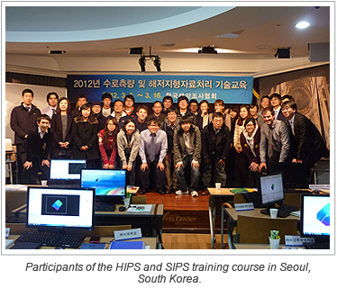
 CARIS recently held a HIPS and SIPS training course in the Geumcheon-gu district of Seoul, South Korea. The training course was lead by CARIS’ Daniel Kruimel and Eduardo Infante. The course was coordinated and delivered through collaboration with HYUNDAI e-MARINE, the CARIS Alliance Par…
Newsroom
Latest news and announcements
-
HIPS and SIPS training in Korea
2012/03/23
Read More
-
A packed house at Oceanology International
2012/03/23
Read More
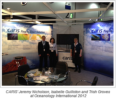 CARIS recently attended Oceanology International 2012 held in London, UK. The event saw a record number of visitors from over 70 countries come together to hear about the latest ocean technologies.
CARIS exhibited at the conference, demonstrating some of our latest hydrographic data processing…
-
Temporal variations in bathymetry and morphology at Gray's Reef National Marine Sanctuary
2012/03/23
Read More
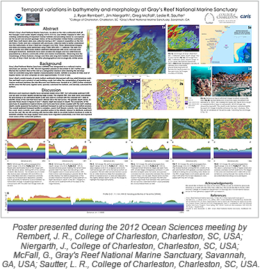 During the recent 2012 Ocean Sciences meeting held in Salt Lake City, Utah, 12 undergraduate students presented eight studies during a poster session on emerging research on the global ocean and society, including science education, outreach and public policy.
In addition to stu…
-
CARIS 2012 to include an Academic Poster Session
2012/03/09
Read More
As our Academic Partnering Program continues to expand across the globe, more and more students are using the power of CARIS software in their educational pursuits and research activities. In an attempt to provide those students with an opportunity to interact with industry professionals from…
-
Enhancing airborne LiDAR bathymetry with HIPS and SIPS
2012/03/09
Read More
 Pelydryn, a hydrographic survey company based in the United Kindgom, is enhancing its airborne bathymetric LiDAR capabilities with the purchase of four additional licenses of HIPS and SIPS. Pelydryn provides a global service which specializes in gathering data in shallow and coastal waters.
Pe…
-
BASE Editor training at CARIS USA
2012/03/09
Read More
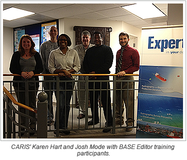 CARIS USA recently held a BASE Editor training course at their office in Alexandria, Virginia. Participants came from the Naval Oceanographic Office, NOAA, and the National Geospatial-Intelligence Agency.
The three-day BASE Editor training course focused on the software operation and workflow …
-
SeaMap: A collaborative, undergraduate-focused Seafloor Mapping Program
2012/03/09
Read More
 During the recent 2012 Ocean Sciences meeting held in Salt Lake City, Utah, 12 undergraduate students presented eight studies during a poster session on emerging research on the global ocean and society, including science education, outreach and public policy.
In addition to student contributi…
-
A new era for The Netherlands Hydrographic Service
2012/03/01
Read More
The Royal Netherlands Navy has successfully executed the final contractual tests of its System for Hydrographic Information Processes - Part 2 (SHIP2) project. The SHIP2 project was implemented to produce a new production system for the Netherlands Hydrographic Office. The project will delive…
-
Professor of Oceanography announced as a keynote speaker at CARIS 2012
2012/02/24
Read More
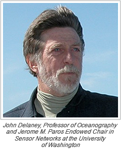 John Delaney, Professor of Oceanography and Jerome M. Paros Endowed Chair in Sensor Networks at the University of Washington, is the latest speaker to join our panel of keynotes at CARIS 2012.
Delaney, who joined the University of Washington faculty in 1977, has published nearly 100 scientific…
-
Latin America's largest port selects HIPS and SIPS
2012/02/24
Read More
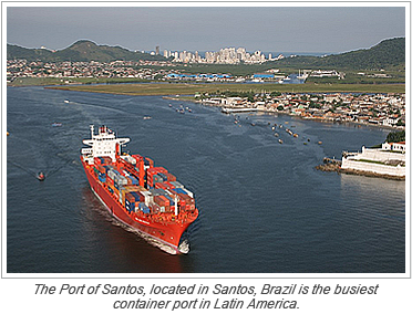 The Port of Santos is located in the city of Santos, Brazil and is the largest port in Latin America. Known for being the busiest container port in Latin America, the port has been modernized in line with developments in the world of maritime technology.
Santos Pilots has been responsible for …
-
New methods for processing data workshop a success
2012/02/24
Read More
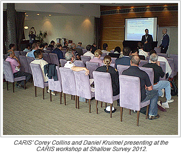 CARIS hosted a full day workshop at Shallow Survey 2012 this week in Wellington, New Zealand. The weeklong conference focused on high resolution surveys in shallow waters.
The workshop put on by CARIS’ HIPS and SIPS Product Manager, Corey Collins, and CARIS Asia Pacific, Daniel Kruimel, …
-
The countdown to CARIS 2012 is on - Have you registered?
2012/02/10
Read More
 The countdown for CARIS 2012 is on. Our 14th International User Group Conference, which will be held June 25 – 28 in Vancouver, British Columbia, Canada is quickly approaching. CARIS 2012 is an ideal opportunity for new and existing CARIS users to congregate and learn about the latest C…
 -
St. Kitts and Nevis adopt CARIS LOTS
2012/02/10
Read More
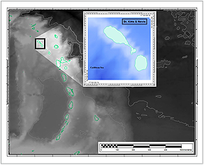 CARIS is very pleased to announce that the Government of St. Kitts and Nevis has recently adopted CARIS LOTS to carry out their boundary delimitation tasks, as part of their Law of the Sea undertaking. The project, sponsored by the Commonwealth Secretariat, will be carried out by the Ministry…
 -
CARIS workshop at Shallow Survey 2012
2012/02/10
Read More
CARIS will be hosting a free full day pre-conference workshop in Wellington, New Zealand on Monday, February 20 at Shallow Survey 2012.
The workshop will cover topics such as the application of post processed kinematic positions to bathymetric data, Geocoder processing workflows, batch process…
-
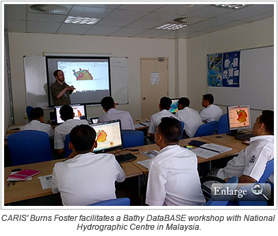
Five-day multibeam surveyor training course
2012/02/10
Read More
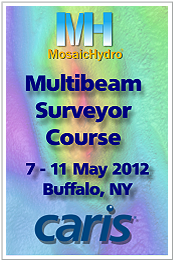 MosaicHydro, in partnership with CARIS, is offering a five-day training course for surveyors new to multibeam echosounder surveys. Whether you are an experienced single beam surveyor or new to marine surveys, this course will teach you to be an effective multibeam operator and postprocessor.
T…
-
Latest service pack for HPD featuring Publication Module
2012/02/10
Read More
The latest release of CARIS HPD has some exciting new enhancements. HPD now features the Publication Module option, which is a new set of tools allowing HPD users to create and maintain notice to mariners, list of lights and other publications together with ENCs and paper charts in the same c…
-
Water Column Imaging in the latest service pack of HIPS and SIPS
2012/02/10
Read More
The latest release of CARIS HIPS and SIPS is now available. HIPS and SIPS 7.1.1 now supports the reading and the displaying of Water Column Imaging data. Initial support for Water Column Imaging includes Kongsberg and Reson 7K sonars. Users can analysis the data directly in 2D or 3D without n…
-
CARIS announces new Paper Chart Composer boot camp at CARIS 2012
2012/01/27
Read More
 The release of the Paper Chart Composer, CARIS’ new desktop paper chart production software, is greatly anticipated by hydrographic offices worldwide. Built using the well established CARIS HPD technology, Paper Chart Composer is a must-have tool to meet the needs of modern chart compil…
 -
Latest service pack for Bathy DataBASE now available
2012/01/27
Read More
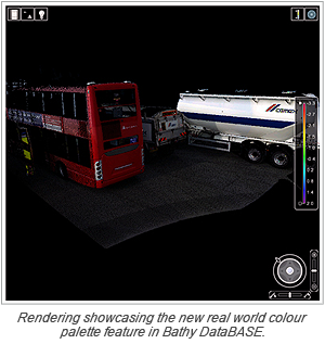 The latest release of Bathy DataBASE has some exciting enhancements including:
- Export of the map window as a georeferenced PDF.
- Enhanced Laser/LiDAR support allowing recorded real world colour palette to be used.
- Ability to directly view and analyze near real time Kongsberg data from the SIS sys…
-
CARIS welcomes new HIPS and SIPS user to the community
2012/01/27
Read More
MICROARS, an engineering and services company from Rio de Janeiro, Brazil, becomes the latest organization to join the HIPS and SIPS user community. HIPS and SIPS will allow them to efficiently process the large volumes of multibeam data that they are collecting for projects with companies li…
-
CARIS LOTS training in Jamaica
2012/01/27
Read More
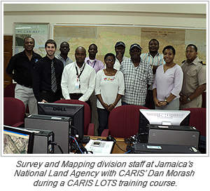 Dan Morash from CARIS was recently in Kingston, Jamaica teaching a five-day training course with the National Land Agency’s Survey and Mapping division on CARIS LOTS.
The objective of the National Land Agency is to produce the most accurate equilibrium line possible between Jamaica and t…
-
Register today for a chance to upgrade your stay at CARIS 2012
2012/01/01
Read More
 During June 25 – 28, 2012, CARIS will be hosting its 14th International User Group Conference in Vancouver, British Columbia, Canada. The four-day event, focusing on exploration and discovery, will feature several demonstrations, presentations, training camps, user group meetings and ne…
 -
Guangzhou Marine Geological Survey selects Bathy DataBASE
2012/01/01
Read More
Guangzhou Marine Geological Survey (GMGS), under the China Geological Survey, is the most recent geological institute to select Bathy DataBASE to address their requirements for the analysis and management of high volume elevation data.
GMGS utilizes a wide range of advanced instruments, includ…
-
Schedule your next training course with CARIS
2012/01/01
Read More
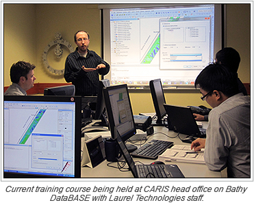 As we usher in the new year, we look forward to another year packed full of CARIS training courses. At CARIS we offer an extensive series of training courses throughout the year at our head office in Fredericton, New Brunswick, Canada and our offices located across the world. Alternatively, w…
 -
Technical notes now available on CARIS Online Customer Services
2012/01/01
Read More
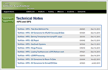 As part of our ongoing commitment to provide CARIS subscription members with technical support when they need it, we’ve recently added technical notes to the CARIS Online Customer Services website. Members can now login to the site and find a variety of technical notes on the CARIS prod…
 -
Discover the difference with water column imaging in HIPS and SIPS
2011/12/30
Read More
-
Looking to the future: mapping the world's oceans
2011/12/30
Read More
-
Bathy DataBASE for Royal Malaysian Navy
2011/12/30
Read More
-
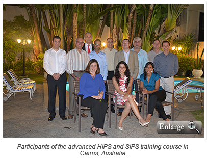
Advanced HIPS and SIPS open training in Australia
2011/12/30
Read More
-
CARIS team in Rio de Janeiro
2011/12/30
Read More
-
Mexico puts HPD to work
2011/12/16
Read More
 In order to improve their workflows the Mexican Navy has been working on the migration of their cartographic production from traditional desktop CARIS tools to the Hydrographic Production Database (HPD).
New ENC and paper charts have been produced with HPD from new survey sources in the areas …
-
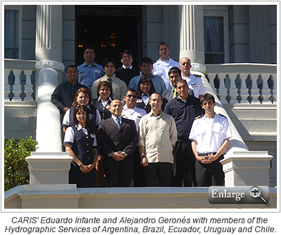
Successful Bathy DataBASE workshop in Chile
2011/12/16
Read More
-
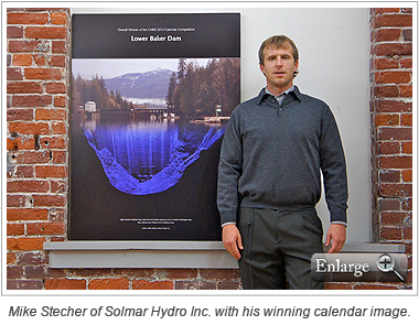
2012 calendar winning entry
2011/12/16
Read More
-
Middle East Hydrographic User Conference in Dubai
2011/12/16
Read More
-
UMG demonstrates live multibeam survey with Dubai Municipality during its Middle East Hydrographic User Conference
2011/12/13
Read More
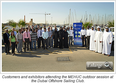
Dubai, United Arab Emirates – November 16, 2011 — During its fifth Middle East Hydrographic User Conference, held November 13 to 16, at Le Meridian Hotel, Dubai, United Arab Emirates, Unique Maritime Group (UMG), one of the world's leading integrated turnkey subsea and offshore so…
-
Vietnam Selects the CARIS Ping-to-Chart Solution
2011/11/18
Read More
Vietnam’s Naval Hydrographic and Oceanographic Department (VNHOD), of the Vietnam People’s Navy, recently selected the CARIS Ping-to-Chart Solution to provide adequate and timely nautical chart and hydrographic data products for Vietnam coastal waters. VNHOD is the recognized…
-
Opening Speaker Announced for CARIS 2012
2011/11/18
Read More
The opening speaker for the CARIS 2012 International Users conference has been announced as the Honorable Keith Ashfield, Canada’s Minister of Fisheries and Oceans. The Department of Fisheries and Oceans is the home of our long-standing partner, the Canadian Hydrographic Service. Minist…
-
Bahamas and Cuba define boundary with LOTS
2011/11/18
Read More
On October 3rd, 2011, a maritime boundary agreement was signed in The Bahamas between the Commonwealth of The Bahamas and the Republic of Cuba. This agreement delineates a median line in accordance with the United Nations Convention on the Law Of the Sea (UNCLOS). According to The Bahamas&rsq…
-
HIPS and SIPS Seminar at RESON User Conference
2011/11/18
Read More
-
CARIS USA training dates announced
2011/11/18
Read More
Join the CARIS USA team at their Alexandria office for the following training courses:
- December 5th- 7th– BASE Editor 3.2 Training
- December 8th- 9th – Bathy DataBASE Server 3.2 Training
- December 12th- 14th – HIPS and SIPS 7.1 Training
If you have news that you would like i…
-
The Survey of 'Miracle Harbour'
2011/10/21
Read More
Isabelle Guilloton, a hydrographic survey specialist with CARIS in the Netherlands, has just returned from a project led by the United Kingdom Hydrographic Office to survey the artificial harbour in Arromanches-Les-Basin, Normandy, France. This harbour known as 'Mulberry B' and the breakwater…
-
Haiti's First Step Towards Chart Production
2011/10/21
Read More
-
Try the Latest Spatial Fusion Enterprise 5.6 for Free
2011/10/21
Read More
-
CARIS Workshops at Hydro 2011: Down Under
2011/10/21
Read More
Daniel and Christian from CARIS Asia Pacific are pleased to be running two workshops at this year’s Hydro 2011 conference in Fremantle, Australia. For more information and to register your attendance please click on the links below.
November 7th, 8:30am to 12:30pm – Bathy DataBASE …
-
Bathy DataBASE 3.2 Service Pack 1 released
2011/10/21
Read More
Bathy DataBASE 3.2.1 is a minor release including enhancements to the CARIS Batch tool, Contour Wizard and a move to the latest BAG library, which provides new compression capabilities resulting in significant reduction in file size amongst other enhancements.
To find out more please view the …
-
CARIS offers free trial of its latest INSPIRE compliant software
2011/10/07
Read More
With the latest release of Spatial Fusion Enterprise v5.6 CARIS is pleased to offer a free trial of its web mapping software allowing you to experience firsthand its capabilities.
Along with several new and improved features, Spatial Fusion Enterprise has now implemented the latest View and F…
-
Nautical Charting First for Nicaragua
2011/09/30
Read More
The Nicaraguan Institute of Territorial Studies (INETER) has embarked on a project with CARIS to produce the first nautical charts of Nicaragua. The Port of Corinto, the largest on the Pacific coast of Nicaragua was identified as the area that would benefit most from improved navigational cov…
-
World's Leading Hydrographic Organizations Team-up to Help Survey "Miracle Harbour"
2011/09/23
Read More
One of the artificial harbours that played a pivotal role in supplying the Allied forces who landed on D-day is to be surveyed using the latest hydrography software and survey techniques.
In 1944, two artificial harbours, called Mulberries, were towed across the English Channel to help supply …
-
Optimizing Your Bathymetric Data Webinar Now Available to Download
2011/09/23
Read More
An edited version of the Bathy DataBASE webinar "Optimizing Your Bathymetric Data" is now available to download or to view on CARIS' YouTube Channel. If you missed the opportunity to view the webinar, or wish to view the demonstration once again, please visit our website: http://www.caris.com…
-
Record Number of Entries for CARIS Calendar Contest
2011/09/23
Read More
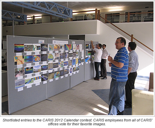
Judging from the number and quality of entries to the 2012 CARIS Calendar Contest, the 2012 Calendar is going to be the best yet. We would like to thank all who took the time to submit their CARIS software images.
Join our Mailing List
Subscribe to email announcementsOur Latest Tweets
Tweets by Teledyne CARIS Follow us on TwitterConnect With Us


