Discover the latest Bathy DataBASE enhancements, including advanced automation, Python integration, and tools for efficient bathymetric data workflows.
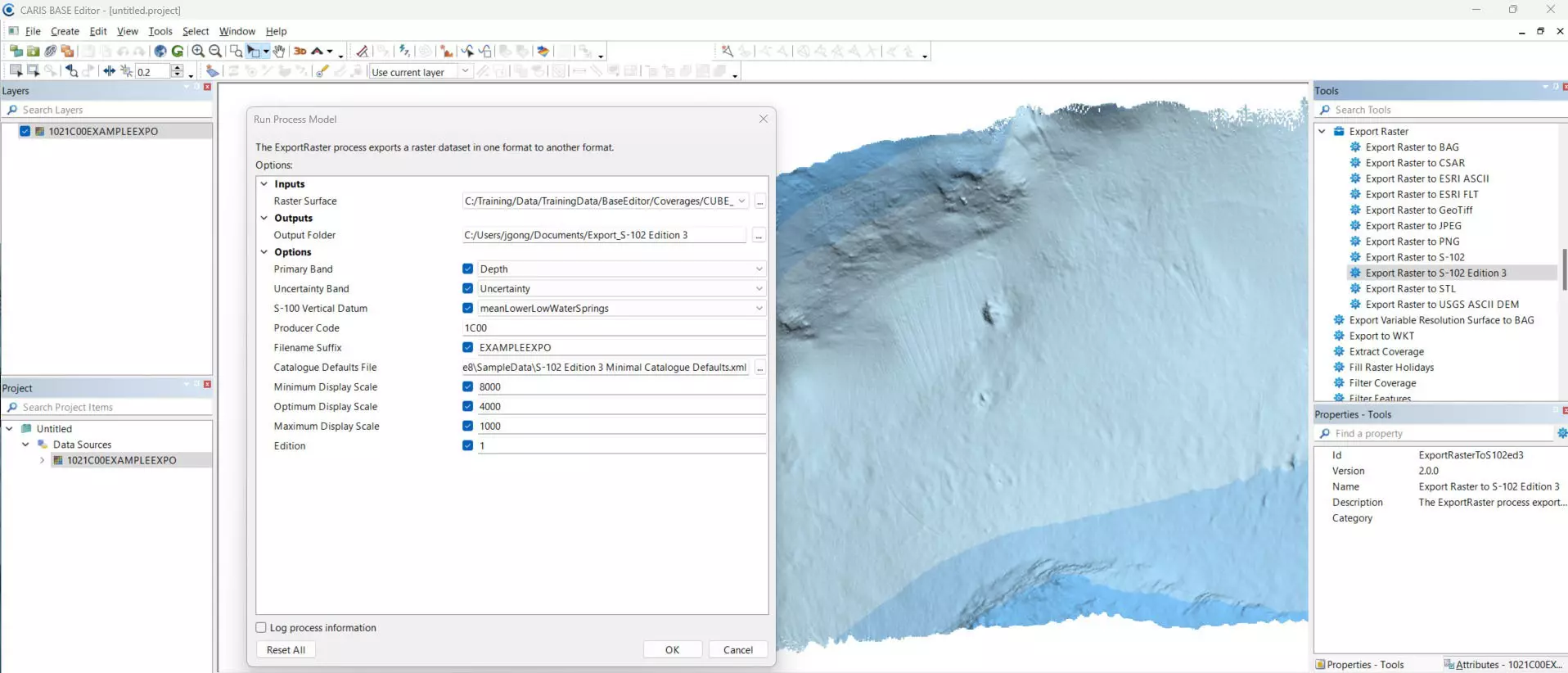
As one of the first in the market, CARIS BASE Editor 6.1.20 now supports the initial operational edition (3.0.0) of the IHO S-102 product specification. With the newly added process, users can now export gridded data into an S-102 Exchange Set with true S-100 compliant folder structure, dataset file naming, and exchange metadata.
During export, a CATALOG.XML file is created to record S100_ExchangeCatalogue metadata. These metadata entries are automatically populated from a default template (an example is provided in the installation folder) as well as some user options. Efforts have been made to require only dataset-specific metadata to be specified through user options, minimizing manual work.
An additional S-100 license is required to use this new function. CARIS Easy View 6.1.20 was released to support the display of the new S-102 Edition 3 datasets.
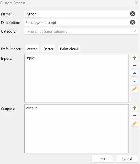
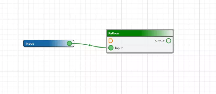
To integrate with third-party solutions or to include with individual business logic, BASE Editor can now use custom processes written in python scripts and use CARIS Process Designer to add them inside a process model. Additionally, CARIS Batch can now be used to launch process models. The combination of these functionalities enhances CARIS automation tools, making it possible to execute automated workflows across CARIS applications.
This array of tools provide the ability to use a single application as a hub to launch automated workflows.
Python scripting is the most flexible way to use CARIS Bathy DataBASE for automating workflows and support is now available for version 3.9, 3.10 and 3.11. Updating to new versions of Python helps safeguard IT infrastructure, so join CARIS in upgrading today. Based on in-house testing, upgrading from Python 3.5 or 3.7 to 3.9, 3.10 or 3.11 should have minimal impact on user scripts.
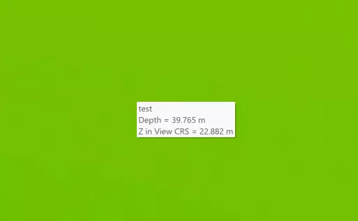
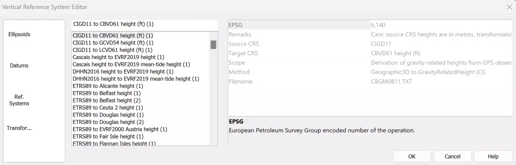
With the release of CARIS BASE Editor 6.1, new tools are available to apply vertical transformations using EPSG registered vertical datums. To provide more flexibility for customers, BASE Editor 6.1 provides the ability to create your own vertical datum using customers' own transformation models.
In addition, a new "on-the-fly" feature delivers vertical transformation to visualize data using a 3D coordinate reference system.
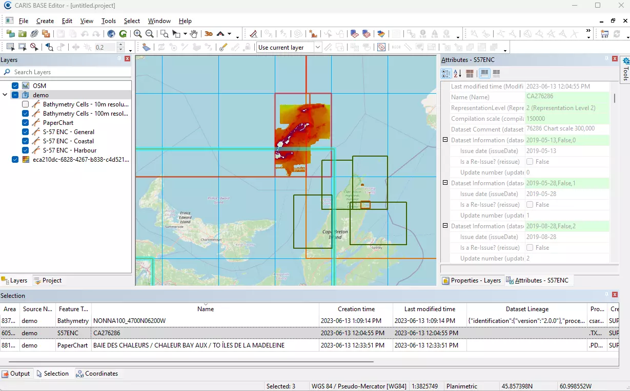
CARIS BASE Editor now provides the ability to configure a connection to a CARIS cloud tenant. CARIS BASE Editor users can visualize the portfolio of data and products distributed through CARIS Cloud tenants.