News
Bathymetric and Topographic Solutions for Environment Agency Geomatics
 The Environment Agency's Geomatics team, located in the United Kingdom, recently purchased CARIS HIPS and SIPS and BASE Editor to further increase their processing and analysis capabilities.
Environment Agency Geomatics is a leader in high quality LIDAR survey, bathymetric surveys and remote sensing data capture for the provision of integrated spatial data solutions. Their geospatial products help support a wide range of applications including environmental planning, flood monitoring, asset management and urban planning. The Geomatics team offers the capability to capture a range of data types including LIDAR, digital aerial photography, hyperspectral and bathymetry.
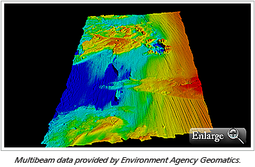
CARIS BV's Michal Borkowksi was recently at their Bath, UK office to conduct HIPS and SIPS training. The course included the CUBE processing workflow in addition to working with the Geomatics team’s own Reson 7K data in developing a streamlined approach to processing the data. As well as having a number of vessels to collect bathymetric data, Environment Agency Geomatics collect and manage vast amounts of topographic LiDAR data and will use BASE Editor to further analyze this data and bring topographic and bathymetric data together.
Join our Mailing List
Subscribe to email announcementsOur Latest Tweets
Tweets by Teledyne CARIS Follow us on TwitterConnect With Us

