
08 April 2026
Explore how HIPS and SIPS 13 and the new EVRT engine can help modernise your hydrographic processing workflows and unlock deeper insight from infrastructure surveys.
HIPS and SIPS 13 introduces focused workflow enhancements and platform modernization designed to help hydrographic and survey teams move confidently from complex source data to validated deliverables.
This release also debuts a powerful new capability: the EVRT engine, enabling vertical and near-vertical infrastructure to be processed using familiar seabed tools in a completely new way.
HIPS and SIPS 13 improves the day-to-day experience of working with large and complex datasets by reducing workflow friction, improving application responsiveness, and expanding accessibility for global teams.
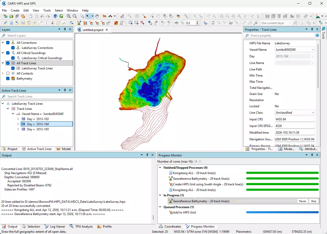
Background processing allows computationally intensive tasks to continue running while users remain productive elsewhere in the software.
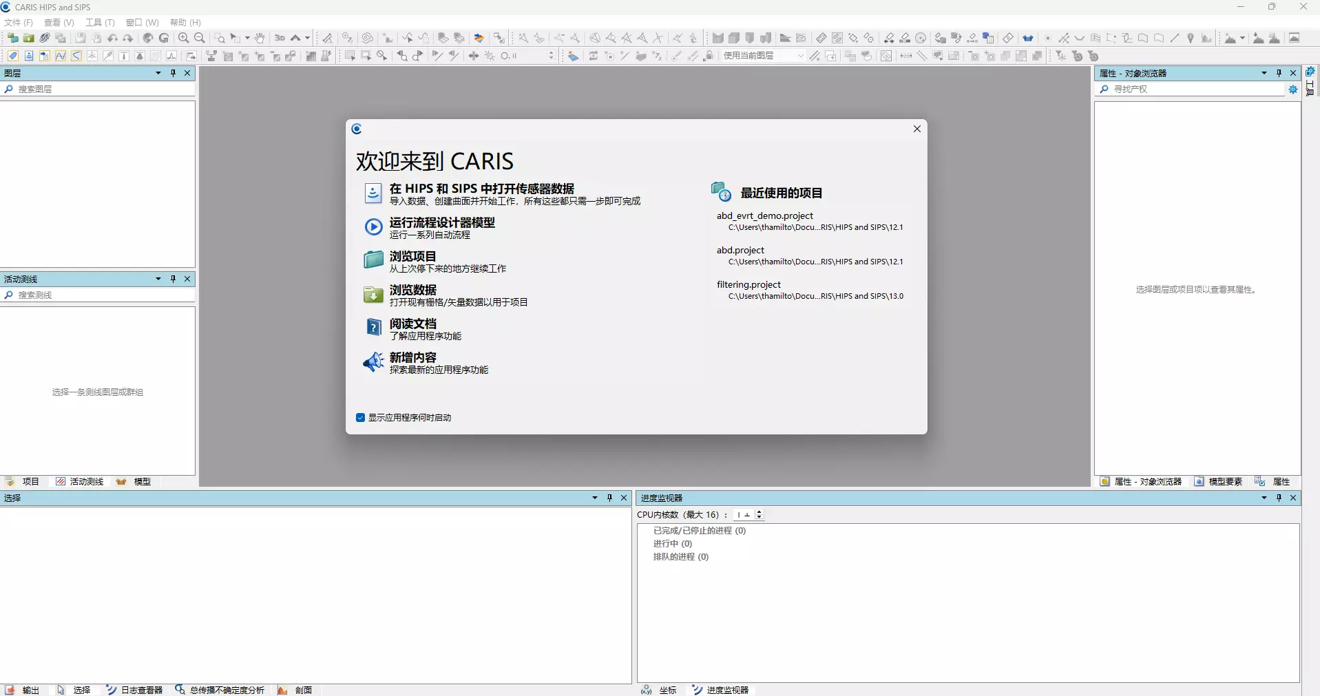
HIPS and SIPS 13 introduces a modernized user interface built on a new technology framework. This transition improves overall responsiveness and provides a cleaner foundation for continued platform evolution and usability enhancements.
The new interface enables regional language support, with Simplified Chinese and French available in this release (additional languages can be added in future releases). This expands accessibility for regional teams and supports broader adoption across international survey operations.
The standout innovation in HIPS and SIPS 13 is the introduction of the EVRT engine — a new processing capability designed specifically to address the challenges of working with vertical and near‑vertical survey data.
Ports, harbours, and infrastructure surveys commonly include features such as:
Traditionally, this data has been analysed using tools optimised for horizontal seabed surfaces, often requiring workarounds and introducing inefficiencies when dealing with vertical geometry.
The EVRT engine transforms survey data from vertical structures into a horizontal alignment‑based coordinate system, allowing it to natively leverage existing seabed processing and analysis tools.
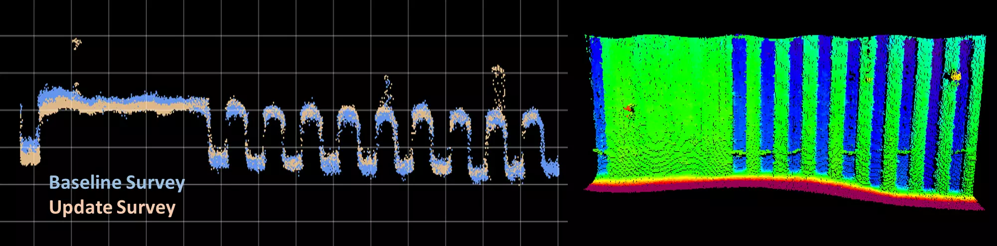
This unlocks a completely new workflow while preserving proven analysis methods.
What this enables:
Background task execution and workflow improvements help reduce bottlenecks and maintain momentum from raw data to validated products.
EVRT enables repeatable, confident processing of vertical structures using tools surveyors already trust.
Language support and UI enhancements make the software easier to deploy across international teams.
Architectural improvements provide a more flexible foundation for ongoing development and modernization.