News
Pilot project Coast-Map-IO TopoBathy Database for UNESCO-IOC
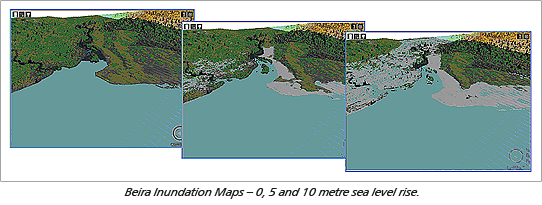
The Coast-Map-IO TopoBathy Database project is an extension of the IOC-IHO project Improving Emergency Response to Ocean-based Extreme Events through Coastal Mapping Capacity Building in the Indian Ocean, which is part of the larger IOC project Indian Ocean Tsunami Warning System. The objective of the TopoBathy Database project is to develop a database for the creation and management of integrated data sets of coastal bathymetric, topographic and ancillary information that is required for prediction of tsunami arrival, run-up and inundation in coastal areas.
The project is sponsored by a Netherlands government development program called Partners for Water. This program presented an opportunity for the Netherlands companies CARIS BV and BMT-ARGOSS BV, in cooperation with the Instituto Nacional de Hidrografia e Navegação (INAHINA) of Mozambique, to jointly develop and implement the pilot TopoBathy Database.
In consultation with IOC/IHO and INAHINA two locations along the Mozambique coast were selected; one near the Port of Beira and the other near the Port of Quelimane. Both areas were considered to be vulnerable to extreme ocean events. CARIS BV was responsible for the installation of the database and training of INAHINA personnel, INAHINA was responsible for collection of existing bathymetric and topographic data of the pilot areas, and BMT-ARGOSS BV for provision of additional satellite-derived bathymetric data of these areas. As leading partner in the project CARIS BV led the overall coordination.
Five different data sources were used for the initial population of the TopoBathy Database for Beira and Quelimane. These datasets were imported into the CARIS Bathy DataBASE application and were transformed to the same horizontal (WGS84) and vertical (MSL) datums. The datasets were combined based on specific rules, ensuring that in overlapping areas the best quality data was used to create the final surface.
CARIS BV established and executed a workflow for the Beira area and created a comprehensive training manual. INAHINA was then able to execute the same workflow to create a combined TopoBathy elevation model for the second area, Quelimane. The results of this pilot project will be presented to UNESCO-IOC shortly.

Join our Mailing List
Subscribe to email announcementsOur Latest Tweets
Tweets by Teledyne CARIS Follow us on TwitterConnect With Us

