News
Inland Electronic Navigation Chart production at the Flemish Hydrography
Safety of navigation on inland waterways is as important as in maritime waters. Inland waterways have specific features and regulations that are different from maritime waterways, making the use of existing Electronic Navigation Charts (ENC) insufficient. As a result, international standards have been developed specifically for Inland ENCs.
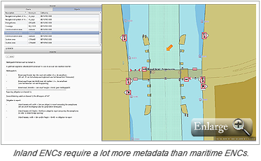
Inland ENCs are intended for use on vessels that travel on inland waterways and have an Inland ECDIS system on board. They contain all chart information required for safe navigation on inland waterways and in mixed traffic zones, where both maritime and inland vessels navigate. Inland ENCs contain additional details about bridges and locks not found in a maritime ENC. Buoys, traffic signs and other features that are specific to inland navigation are also charted.
Flemish Hydrography in Belgium has been producing Inland ENCs since 2010 using CARIS Hydrographic Production Database (HPD). Prior to that HPD was already being used for the production of maritime ENCs by Flemish Hydrography, making the database driven solution the obvious choice. Currently the Flemish Hydrography is using the Inland ECDIS Standard 2.3.
For a copy of the full paper Inland Electronic Navigation Chart production at the Flemish Hydrography (Flanders - Belgium) presented at Hydro 12 conference visit the conference proceedings website.
Join our Mailing List
Subscribe to email announcementsOur Latest Tweets
Tweets by Teledyne CARIS Follow us on TwitterConnect With Us

