News
Nautical Charting First for Nicaragua
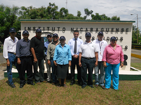
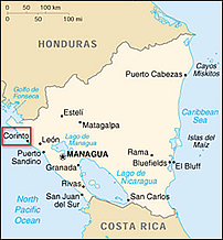
The Nicaraguan Institute of Territorial Studies (INETER) has embarked on a project with CARIS to produce the first nautical charts of Nicaragua. The Port of Corinto, the largest on the Pacific coast of Nicaragua was identified as the area that would benefit most from improved navigational coverage.
CARIS deployed its chart production software and has just completed 5 days of in country training in the capital Managua. The training focused on paper chart production in accordance with the International Hydrographic Organization (IHO) standards.


Juan Carballini, a CARIS account manager and chart production expert was excited to get a chance to visit Nicaragua and work with INETER. "The historic city of Managua was a first for me and CARIS. The trainees were keen to learn and grasped the software quickly, I look forward to visiting them again soon".
In 2012, the project area will be expanded to cover other important Nicaraguan waters, with Electronic Navigational Charts (ENCs) for the same areas also being produced. CARIS will continue to work closely with INETER to help Nicaragua meet its hydrographic survey and charting objectives.
Join our Mailing List
Subscribe to email announcementsOur Latest Tweets
Tweets by Teledyne CARIS Follow us on TwitterConnect With Us

