News
World's Leading Hydrographic Organizations Team-up to Help Survey "Miracle Harbour"
One of the artificial harbours that played a pivotal role in supplying the Allied forces who landed on D-day is to be surveyed using the latest hydrography software and survey techniques.
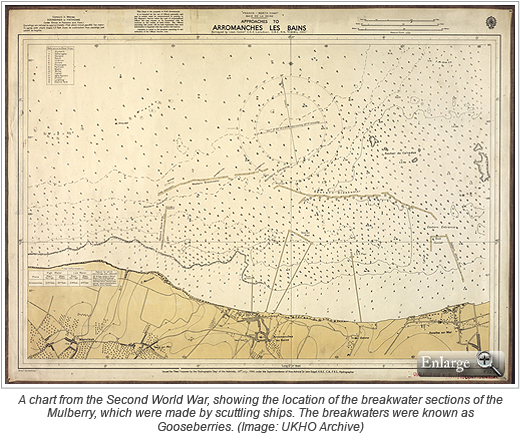
In 1944, two artificial harbours, called Mulberries, were towed across the English Channel to help supply the Allied invasion force as they fought to liberate France. When constructed off the coast of Normandy, each of the mobile, prefabricated harbours consisted of 600,000 tons of concrete with 33 jetties and 10 miles of floating roadways. Mulberry "A", located off Omaha beach, was severely damaged in a storm shortly after construction, but Mulberry "B", also known as Port Winston, continued to effectively supply the British and Canadian invasion forces throughout 1944.
 The Mulberry harbours were brilliantly conceived in the spirit of "necessity being the mother of invention" and are arguably the greatest engineering achievement of the Second World War. After the failure of an Allied raid on the port of Dieppe in 1942, British Commodore John Hughes-Hallett declared that if a port could not be captured, then one should be taken across the Channel. This idea was initially met with derision. Yet, Albert Speer, Germany's Second World War Minister of Armaments and War Production described the resulting Mulberry harbours as simple genius.
An alliance of hydrographic organizations, led by the United Kingdom Hydrographic Office (UKHO), are sharing their expertise and equipment during a two-week survey mission of Mulberry "B" set to take place in October. CARIS are supplying their bathymetric processing software, HIPS and SIPS, as well as their analysis and compilation software, BASE Editor, plus two dedicated computers.
"UKHO has had a long association with CARIS HIPS and the CARIS Bathy Data Base and the support of CARIS to this project is very much appreciated," said Chris Howlett, head of the UKHO Seabed Data Centre. "Using CARIS HIPS to process the gathered data and then storing it within Bathy DataBASE will help ensure that we get the most from the data and that it remains discoverable in the future."
Trish Groves, CARIS' account manager for the United Kingdom, is pleased that CARIS can offer assistance to the project. "We are very excited to be involved. To rediscover and highlight part of our heritage is inspiring and helps promote hydrography to a wider audience," she said.
For more news on the Mulberry Survey please visit: www.mulberrysurvey.co.uk
Join our Mailing List
Subscribe to email announcementsOur Latest Tweets
Tweets by Teledyne CARIS Follow us on TwitterConnect With Us

