News
Latest service pack for Bathy DataBASE now available
 The latest release of Bathy DataBASE has some exciting enhancements including:
- Export of the map window as a georeferenced PDF.
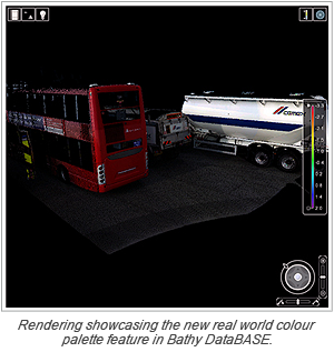
- Enhanced Laser/LiDAR support allowing recorded real world colour palette to be used.
- Ability to directly view and analyze near real time Kongsberg data from the SIS system.
- Data layers with different coordinate systems can now be viewed together in the 3D view.
Users can download the service pack from the Online Customer Services website today!
Published 2012-01-27
Join our Mailing List
Subscribe to email announcementsOur Latest Tweets
Tweets by Teledyne CARIS Follow us on TwitterConnect With Us

CARIS HIPS & SIPS Professional
